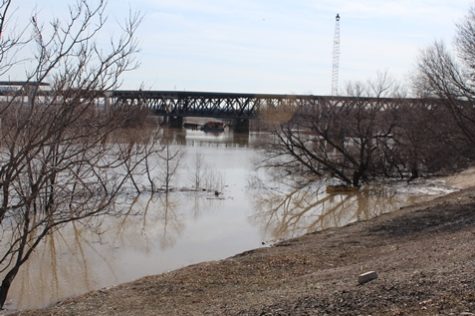
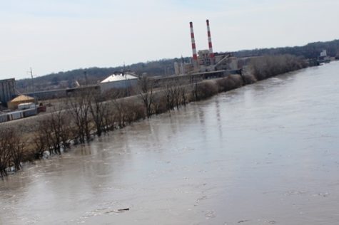
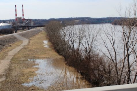
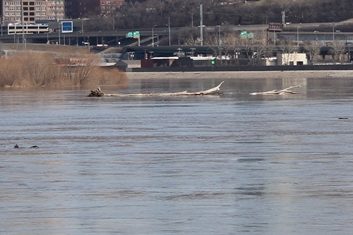
As most of you are aware, the Missouri River has been in the news as flood waters continues to rise, impacting communities and areas along the river. It’s also amazing to see the before and after photos of streets, buildings and parks being transformed into rivers. Case in point is Kaw Point Park, the destination for our annual Fairfax Festival, and where the Kansas and Missouri Rivers meet. As you will see in the photos below, the iconic Lewis and Clark sculpture is partially buried under water. This is just another indication that the river has risen ~20-30 ft. but still within the Fairfax Levee. This area of Kaw Point park is designed for flooding and will hopefully just need debris clean up when it’s over.
From Steve Dailey, Fairfax Drainage District
Keeping a close eye on this development is Steve Dailey from the Fairfax Drainage District (FDD) and he recently shared some updates with us and they are presented in chronological order.
Missouri River Updates
=====UPDATE 4/3/19=======

Conditions: The Missouri River is currently at Stage 26.5 ft. and continues to fall. It is projected to drop to around 20 ft. by the weekend assuming we do not receive significant rainfall in the system.
The pressure relief wells and pumping stations are performing well and keeping the landside of the levee sufficiently de-watered. The flood control works continue to be monitored 24/7 and this will continue until the pressure relief wells become inactive which should occur over the next 2 to 3 days.
Today makes our 17th day of continuous manned pump station operation.
We anticipate that this will be our last update for this event. We will start new notifications if River Stages are projected to exceed 27 ft.
Thank you —
Stephen P. Dailey, P.E., General Manager
Fairfax Drainage District
=====UPDATE 3/25/19=======
This is a brief update of the current and projected Missouri River Conditions:
The Missouri River crested early Sunday morning at Stage 34.8 ft.
Presently, the Missouri River is at Stage 33.5 ft. and is projected to fall below Flood Stage (32.0 ft) by this time tomorrow and continue falling the rest of the week.
However, precipitation is in the forecast beginning Wednesday and continuing through the end of the week so this could cause the river to rise again.
The pressure relief wells and pumping stations are performing well and keeping the land side of the levee sufficiently de-watered. The flood control works are being monitored 24/7 and this will continue until the River Stage nears 27 ft.
We will keep you apprised via email if there are any significant developments. In the meantime, feel free to email or call me if you have any questions.
Thank you —
Stephen P. Dailey, P.E., General Manager
Fairfax Drainage District
=====UPDATE 3/22/19=======
Dear FDD Constituent,
This is a brief update of the current and projected Missouri River Conditions:
Presently, the Missouri River Stage is at 30.7 ft. It is projected to crest tomorrow (Saturday) at approximately 33 ft. Note: This projection includes 48 hours of forecasted precipitation.
As rain is in the forecast, actual precipitation could alter the crest slightly up or down. Flood stage (ie when the river comes out of its banks) is Stage 32.0, so the river will exceed flood stage by about 1.0 ft.
As previously mentioned the Fairfax Levee height corresponds to Stage 52.0 ft., so there will still be about 19.0 ft. of freeboard above the forecasted crest of 33 ft. The pumping stations are performing well and we have not any any problems or difficulties. They are being monitored 24/7 and this will continue well into next week as the River Stage nears 27 ft.
We will keep you apprised via email if there are any significant developments. In the meantime, feel free to email or call me if you have any questions.
Thank you —
Stephen P. Dailey, P.E., General Manager
Fairfax Drainage District
=====UPDATE 3/19/19=======
 As a matter of past practice, The Fairfax Drainage District likes to keep constituents apprised of our operations when Missouri River levels exceeds stage 30 ft., especially when the news and weather reports for the region begin to talk about flooding, levee failures or over-toppings. Flood stage for the Kansas City area is 32.0 ft. as measured from the Hannibal Bridge gauging station. Flood stage simply means the level at which the river starts to come out of its banks. For areas not protected by levees (such as the riverside park in Parkville, MO), these areas will typically begin to flood when the river exceeds flood stage. For areas protected by a levee (such as Fairfax), even though the river may rise above flood stage and come out of its banks, it still will be channeled by the levee and not flood the protected area.
Currently (morning of March 19), the KC River Stage is 29.4 ft. and the Corps of Engineers is forecasting the river to slowly rise to about 31.6 ft. by Friday morning, March 22nd, before receding to normal levels. Note: the projection includes 24 hrs. of any forecasted precipitation built into the model. Therefore, it is conceivable that the river could rise above 31.6 ft. since the projection does not have any precipitation built in to the model that may occur after 24 hours from now. Also note: the levee crown corresponds to a river stage of 52 ft. which is nearly 22 ft. higher than the current projection, so as you can see there is no imminent threats of flooding in areas protected by levees in the Kansas City metropolitan area.
Currently, we have activated our pumping stations to pump rising groundwater along the levee and any localized precipitation that may occur. We are manning the flood control works around the clock now until the river falls below about 27 ft. then return to automation mode.
The FDD will monitor this situation and keep you apprised if there are any significant developments. Feel free to email me or call if you have any questions.
Stephen P. Dailey, P.E., General Manager



Those Blue Jackets really look good!!